Packing For Your New Zealand Walking Holiday
So you’ve booked your New Zealand walking tour and are excited for the trip of a lifetime! Depending on when you’re heading over, your next step may well be to start thinking about what to bring. If this is the first time you’ve travelled to New Zealand, you are bound to have questions about what you might need. We have put together a handy list to cover all possible bases and to make sure you will be ready for your ‘trip of a lifetime’.
Getting ready for your walking tour - General Tips:
Dress code: New Zealand is typically an informal place, so bring comfortable casual clothes. Even in the cities, dress codes are pretty uncommon and don't go beyond smart casual. If you read a sign saying: "No thongs" don't panic - it's another word for flip-flops, jandals, pita-patas etc, depending on where you are from.
One of the great things about New Zealand is that you can be in a restaurant and you'll see one table of people looking like they've just come from the beach sat right beside another group of people looking like they've come from a wedding. It looks totally normal and everyone seems to fit right in. You'll see what we mean when you get here, it's just a 'Kiwi' thing and we reckon you'll love it!
General guideline: Clothing should be lightweight, hard-wearing and easily washable. People often tell us they have packed too many clothes; you will have plenty of opportunities to do laundry so don’t be afraid to pack quite lightly. If you are travelling in the warmest summer months (January to March) bring loose-fitting clothing, as this will help you to keep cool. Bear in mind that in New Zealand you can experience four seasons in one day!
On all of our tours we stay in very comfortable accommodation each night and nearly every evening (with the exception of Martins Bay and a few nights on the Kiwi Classic) you will have access to your suitcase. There are laundry facilities in most of our overnight spots too, so you don't need to pack too much.

Sensible layers and sun protection!
Getting ready for your walking tour - Suggested Packing List:
For walking
- A good waterproof rain jacket and pants (Gore-tex or similar)
- Polar Tec or similar windproof fleece jacket / sweater
- Non-cotton base layers (top and bottom); choose fabrics such as polypropylene, Capilene or Thermax. We use and recommend Merino wool.
- One pair of hiking boots or strong walking shoes (waterproof, with ankle support)
- Three pairs thick walking socks
- Short sleeved shirts (quick dry material)
- Long-sleeved shirts (quick dry material)
- Warm hat and gloves
- Sunhat / cap
- Lightweight, quick-dry long pants (or shorts if you prefer)
- Mid-sized backpack (for day hiking)
- Water bottle or Camelbak (minimum 1 litre)
- Dry bag for clothes/valuables
- Walking poles, you can also hire them off us for $25
- If you’re on the Kiwi Classic, we can also provide you with a 65-litre hiking pack and a sleeping bag and liner rather than you bringing the items from home
General clothing
- 1 pair jeans or other casual trousers
- 2 pairs shorts (or a skirt)
- 3-4 shirts (think layering for colder days; quick-dry clothes are best)
- 2 button-up long sleeve shirts
- 1 sleep shirt & sleep shorts (or whatever you usually sleep in)
- 1 light sweatshirt or long-sleeve t-shirt
- 1 swimming suit
- Underwear
- 4-5 pairs socks (both thin and thick)
- 1 pair sports sandals (like Tevas)
- 1 or 2 changes of smart casual clothing for restaurant dining
- 1 pair cycle shorts if liked (not necessary for World Heritage or Sweet North)

Weather can be changeable in New Zealand; you won't regret bringing a good waterproof jacket, just in case.
Other items
- Motion sickness tablets (if you require them)
- Insect repellent (with Deet)
- Sunglasses
- Medications and copies of prescriptions
- Sunscreen and lip balm
- Toiletries
- Towel
- Current converter and outlet adapter
- Travel alarm clock or watch with alarm
- Handkerchiefs
- Spare bootlaces
- Phone and charger
- Camera and spare memory cards
- Flashlight / headlight and spare batteries
- Binoculars (if you like)
Documentation
- Passport & travel documents
- Travel insurance details
Luggage
- One full-sized suitcase or travel bag
- One daypack
Keeping warm: We visit alpine regions on our walking tours and can encounter cold weather at any time of the year. The best way to beat the cold is by wearing two or three thin layers of clothing, rather than one thick layer. Air trapped between layers becomes warmed by the body and instant insulation from the effects of cold is created. Layering also helps keep us nice and dry too.

Bringing extra layers ensures you're ready for the warm, fine weather at the bottom of your climb - and a chance of snow at the top!
It is also important to have a proper covering for head, hands and feet. As a general rule, wool, silk and synthetic fabrics are recommended as they trap air better than cotton. These items are available in a wide range of clothing articles in soft, stretchy, water and wind-resistant fabrics. Jerseys, camisoles and underwear help wick moisture away from your body and can act as your first layer.
For your second layer, you might want a sweater. A third layer, if necessary, may be a cardigan-type jacket made of a waterproof synthetic or a lightweight down vest.
The sun: In our trip galleries, you'll see lots of photos of us having fun in the sun, so make sure you bring a good sunhat and sunglasses. We always have sunscreen on hand, but feel free to bring your own if you have a preference for a certain type.
Footwear: We recommend you bring sturdy walking shoes or hiking boots. If you decide to take hiking boots, make sure you wear them in before you travel. Pop some spare laces in your bag too, just in case. Sports sandals, boat shoes or beach footwear may be useful in some locations.
Dry bags: These are really handy. They come in all sizes and we recommend at least one for your spare clothes on day hikes and one for electronic equipment like phones or cameras. These are available in most outdoor supply stores.
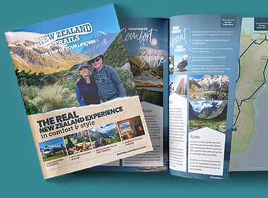
We hope this guide is helpful for you to prepare for touring with us at New Zealand Trails. If you'd like more information about our tours then request your free brochure here. If you have any questions at all about what to pack for your New Zealand trip please contact us and we will help you work it out!
 Share
Share
 Tweet
Tweet
 Email
Email
 Share
Share